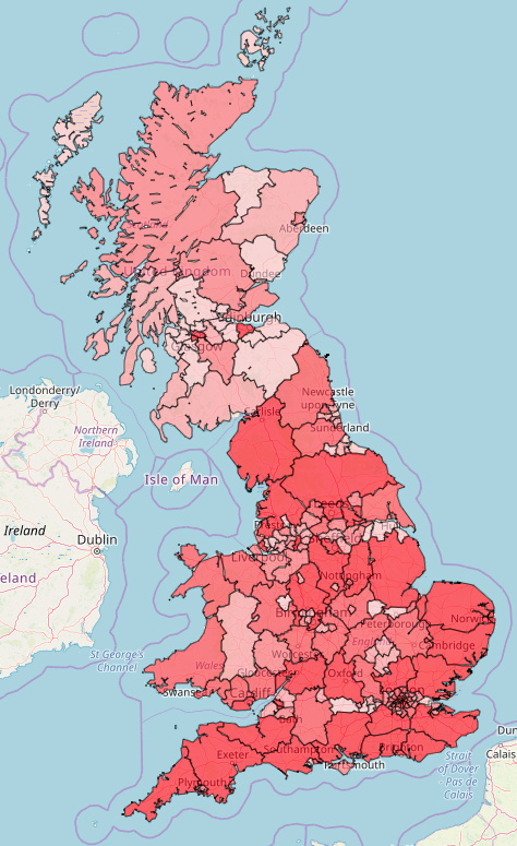
The Food environment assessment tool (Feat) enables detailed exploration of the geography of food retail access across England, Scotland and Wales.
It is designed around the needs of professionals in public health, environmental health and planning roles, locally and nationally.
Use it to map, measure and monitor access to food outlets at a neighbourhood level, including changes over time.
NEW! We listened to your feedback and launched major updates to Feat in September 2019. What's changed?
Feat features
Use Feat to:
- support planning decisions
- generate local evidence for the development of Obesity Strategies, Local and Neighbourhood Plans, JSNAs and Strategic Planning Documents
- compare food access between neighbourhoods, and see where is changing fastest
- target interventions, and test the effectiveness of planning policies
The science behind Feat
Feat has been developed by the MRC Epidemiology Unit at the University of Cambridge. It is underpinned by the latest scientific evidence about how food access in our neighbourhoods affects our dietary choices and body weight. Find out more about the evidence.
Contact the Feat team: feat-tool@mrc-epid.cam.ac.uk